
PHYSICAL FEATURES OF INDIA // CBSE CLASS 9 SST GEOGRAPHY QUESTION ANSWER
IMPORTANT QUESTION

Q.1. How can you say that India is a vast country with varied landforms?
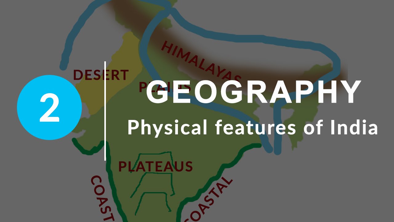
Ans. Our country has practically all major physical features of the earth, i.e., mountains, plains, deserts, plateaus and islands.
Q.2. Which factors modified the relief features of India?
Ans. Besides geological formations, a number of processes such as weathering, erosion and deposition have created and modified the relief to its present form.
Q.3. What is the ‘Theory of plate Tectonics’?
Ans. According to this theory, the crust of the earth (upper part) has been formed out of seven major and some minor plates. The movement of the plates results in the building up of stresses within the plates and the continental rocks above, leading to folding, faulting and volcanic activity.
Q.4. What was Gondwana land?
Ans. The Gondwana land included India, Australia, South Africa, South America and Antarctica as one single landmass.
Q.5. What was the result of collision of the Indo-Australian plate
with Eurasian plate?
Ans. Due to this collision, the sedimentary rocks which were accumulated in the geosyncline known as the Tethys were folded to form the mountain system of western Asia and Himalaya.
Q.6. What is the other name for ‘Himadri’?
Ans. Inner Himalayas.
Q.7. Name the highest peak of Himalayas.
Ans. Mount Everest Nepal (8,848 metres).
Q.8. Name the highest peak of Himalayas in India.
Ans. Kanchenjunga (8,598 metres).
Q.9. Name some of the highest peaks of Himalayas.
Ans. Dhaulagiri (8,172 metres), Nanga Parbat (8,126 metres), Annapurna (8,078 metres), Nanda Devi (7,817 metres), & Namcha Barwa (7,756 metres).
Q.10. Name the important passes located in Himalayas.
Ans. Karakoram Pass, Shipkila Pass, Bomdilass Pass.
Q.11. Where is Himalayan range ‘Himachal’ located?
Ans. The range lying to the south of the Himadri forms the most rugged mountain system and is known as Himachal or lesser Himalaya.
Q.12. Which famous valleys are located in ‘Himachal’?
Ans. The Famous valleys of Kashmir, the Kangra and Kullu are located in ‘Himachal’.
Q.13. Which is the outer most range of Himalayas?
Ans. The outermost range of Himalayas is called the ‘Shiwaliks’.
Q.14. What is average width and altitude of Shiwaliks?
Ans. They extend over a width of 10–50 kms and have a altitude varying between 900 and 1,100 metres.
Q.15. What are ‘Duns’?
Ans. The longitudinal valley lying between lesser Himalayas and the Shiwaliks are known as Duns.
Q.16. Name some well known ‘Duns’.
Ans. Dehra Dun, Kotli Dun & Patti Dun are some of the well known Duns.
Q.17. Which hills are called ‘Purvanchal’?
Ans. The Purvanchal comprises the Patkai hills, the Naga Hills, Manipur, the Mizo hills, Garo, Khasi and Jaintia hills.
Q.18. How Purvanchal or Eastern hills are formed?
Ans. These hills running through the north eastern states are mostly composed of strong sandstones which are sedimentary rocks. They are covered with dense forests; they mostly run as parallel ranges & valleys.
Q.19. Which three main river system helped in forming Northern plains?
Ans. The three main river systems are—The Indus, the Ganga and the Brahmaputra.
Q.20. What are ‘distributaries’?
Ans. The rivers in their lower course split into numerous channels due to thedeposition of silt. These channels are known as ‘distributaries’.
Q.21. What does ‘doab’ mean?
Ans. ‘Doab’ is made up of two words – ‘do’ means two and ‘ab’ means water.
Q.22. To which parts Ganga Plains are extended?
Ans. The Ganga Plain extends between Ghaggar and Teesta rivers. It is spread over the states of North India, Haryana, Delhi, U.P., Bihar, partly Jharkhand and West Bengal.
Q.23. What is ‘Bhabar’?
Ans. The rivers after descending from the mountains deposit pebbles in a narrow belt of about 8 to 16 kms in width lying parallel to the slopes of the Shiwaliks, known as ‘bhabar’.
Q.24. Which region is called ‘Terai Region’?
Ans. South of bhabar, the streams and rivers re-emerge and create a wet swampy & marshy region known as Terai.
Q.25. Name the two major divisions of the Peninsular Plateau?
Ans. They are — The Central Highlands and The Deccan Plateau.
Q.26. Where are The Central Highlands located?
Ans. The part of the Peninsular Plateau lying to the north of the Narmada river covering a major area of the Malwa Plateau is knows as Central Highlands.
Q.27. What is the average elevation of Western Ghats?
Ans. Their average elevation is 900–1600 metres.
Q.28. Name the highest of Western Ghats.
Ans. The highest peak of Western Ghats is Anai Mudi (2,695 metres).
Q.29. Name the highest peak of Eastern Ghats.
Ans. The highest peak of Eastern Ghats is Mahendra Giri (1,501 metres).
Q.30. Which is the only large river of Indian Desert of Rajasthan?
Ans. The Luni river.
Q.31. What are Barchans?
Ans. They are crescent–shaped sand dunes covering large areas of
Rajasthan’s Thar desert.
Q.32. By what names are Eastern Coastal plains called?
Ans. In northern part, it is referred to as the Northern Circar while the
Southern part is known as the ‘Coromandel Coast’.
Q.33. Where is Chilika Lake located?
Ans. Odisha, to the south of the Mahanadi Delta.
SHORT ANSWER TYPE QUESTION
Q.1. What do you mean by the ‘Theory of Plate Tectonics’?
Ans. Earth scientists have explained the formation of physical features withthe help of some theories and one such theory is the ‘Theory of Plate Tectonics’. According to this theory, the crust i.e., the upper part of the Earth has been formed out of seven major and some minor plates. The movement of these plates resulted in building up of stresses within the plates, leading to folding, faulting and volcanic activities.
Q.2. What are the three types of plate movements on the Earth?
Ans. (i) Convergent boundary: When some plates come towards each other, they form a convergent boundary. It may also be called folding movements.
(ii) Divergent boundary: When some plates move away from each other they form a divergent boundary. It is also called faulting movements.
(iii) Transform boundary: In the event of two plates coming together, they may either collide and crumble or may slide under the other and form the transform boundary.
Q.3. How were the northern plains formed?
Ans. (i) The northern plains have been formed by the interplay of the three major river systems—the Indus, the Ganga and the Brahmaputra along with their tributaries.
(ii) The Himalayan uplift out of the Tethy’s sea and subsidence of the northern flank of the Peninsular plateau resulted in the formation of a large basin. In due course of time, this depression gradually got filled with the deposition of the sediments by the rivers flowing from mountains in thenorth. A flat land with extensive alluvial deposits by these rivers led to the formation of the Northern Plains of India.
(iii) With a rich soil cover, combined with adequate water supply and favourable climate, it is agriculturally a very productive part of India.
Q.4. Give a brief description of the Himalayan mountains.
Ans. The Himalayas, geologically young and structurally fold mountains stretch over the northern borders of India. These mountain ranges run in a west-east direction from the Indus to the Brahmaputra. The Himalayas are loftiest and one of the most rugged mountain barriers of the world. They form an arc, which covers a distance of 2,400 kilometres.
Q.5. Describe the three parallel ranges of the Himalayas.
Ans. The three parallel ranges of the Himalayas are:
(i) Himadri (Great or Inner Himalayas)
- It is the most continuous range. The northernmost range is called the
- Himadri. It consists of loftiest peaks with an average height of 6,000 metres.
- It contains all the prominent peaks. It remains snow covered throughout the year, resulting into the formation of glaciers and some perennial rivers.
(ii) Himachal (Lesser Himalayas)
- It lies to the south of Himadri and forms the most rugged mountain system.
- The ranges are mainly composed of highly compressed and altered rocks.
- Average height is between 3,700 to 4,500 metres. Some famous ranges are
- the Pir Panjal range, Dhaula Dhar and Mahabharat ranges. It has some famous valleys like Kullu, Kangra and Kashmir. They are known for their hill stations. The average width is 50 Km.
(iii) Shiwaliks (Outer Himalayas)
- This is the outermost range of the Himalayas. Its height varies between 900 and 1,100 metres.
- These ranges are composed of unconsolidated rock material, so these ranges are prone to earthquakes and landslides.
- These longitudinal valleys lying between lesser Himalayas and Shiwaliks are called ‘Duns’ like Dehra Dun, Kotli Dun and Patti Dun, etc.
Q.6. Name the highest peaks of the Himalayas with their heights.
Ans. (i) Mt. Everest – 8,848 metres, Nepal
(ii) Kanchenjunga – 8,598 metres, India
(iii) Makalu – 8,481 metres, Nepal
(iv) Dhaulagiri – 8,172 metres, Nepal
(v) Nanga Parbat – 8,126 metres, India
(vi) Annapurna – 8,078 metres, Nepal
(vii) Nanda Devi – 7,817 metres, India
(viii) Kamet – 7,756 metres, India
(ix) Namcha Barwa – 7,756 metres, India
(x) Gurla Mandhata – 7,728 metres, Nepal
Q.7. Classify the Himalayas on the basis of regions from the West toEast.
Ans. This division of the Himalayas is demarcated by the river valleys.
(i) Punjab Himalayas: This part of the Himalayas lies between the rivers Indus and Satluj. It is also known as Kashmir and the Himachal Himalayas.
(ii) Kumaon Himalayas: This part of the Himalayas lies between Satluj and Kali rivers.
(iii) Nepal Himalayas: This part of the Himalayas lies between Kali and Teesta rivers.
Q.8. What do you know about ‘Purvanchal’?
- Ans. The Eastern Hills are collectively known as ‘Purvanchal’.
- These hills running through the north-eastern states are mostly composed of strong sandstones which are sedimentary rocks.
- They are covered with dense forest; they mostly run as parallel ranges and valleys.
- Purvanchal comprises of the Mizo hills, Naga hills, Manipur hills, Patkai Bum, Garo, Khasi and Jaintia hills.
Q.9. How are riverine islands formed?
Ans. The rivers coming from the northern mountains carry alluvium with them and do the depositional work. In the lower course, due to gentle slope, the velocity of the river decreases which results in the formation of riverine islands.
Q.10. Classify the Northern Plains on the basis of its location.
Ans. The Northern Plains are broadly divided into three sections:
(i) Punjab Plains: The western part of the Northern Plain is called the Punjab Plains. It is formed by the river Indus and its tributaries.
(ii) Ganga Plains: It extends between Ghaggar and Teesta rivers. It is spread over the states of North India, i.e., Delhi, Haryana, UP, Bihar and parts of Jharkhand and West Bengal.
(iii) Brahmaputra Plains: To the east of the Ganga plain lies the Brahmaputra Plain. They cover the areas of Assam and Arunachal Pradesh.
Q.11. Write any three characteristics of the Central Highlands.
Ans. The part of the Peninsular plateau lying to the north of the Narmada river, covering a major area of the Malwa plateau is known as the ‘Central Highlands’.
Its three characteristics are:
(i) They stretch from the north-west with the Aravalis, further merging with
the sandy and rocky desert of Rajasthan.
(ii) They are wider in the West but narrower in the east.
(iii) The eastward extension of this plateau is locally known as ‘Bundelkhand’ and ‘Baghelkhand’. The ‘Chotanagpur plateau’ is the easternmost part of this plateau, which is drained by the river Damodar.
Q.12. Differentiate between western coastal plains and eastern coastal plains.
Ans. Western Coastal Plains
(i) It is a narrow plain.
(ii) This part of the plain receives rains from South West Monsoons.
(iii) Narmada and Tapti rivers flow from it, forming estuaries.
Eastern Coastal Plains
(i) It is a wide and levelled plain.
(ii) Coromandel Coast receives rains from North East Monsoons.
(iii) All the major peninsular rivers form a delta by making the land fertile.
Q.13. Where are the famous Passes of Himalayas located?
Ans. Shipkila Pass: It is located on the Tibet–Himalaya Road. It lies in the Satluj valley in Himachal Pradesh.
Nathula Pass: It is on the way from India to Lhasa. It lies in the Chumbi
valley in Sikkim.
Bomdila Pass: It lies further east in Arunachal Pradesh. It leads to
Arunachal–China border.
Q.14. What do you know about valleys and duns in Himalayas?
Ans. The Kashmir valley is so beautiful that it is described as ‘paradise on
the earth’. The Kangra and Kullu valleys in Himachal Pradesh are also beautiful. The Kathmandu valley in Nepal is famous as well. Small valleys in Kumaon Himalayas of Uttarakhand are called ‘duns’. Some of the famous duns are Dehra Dun, Kotli Dun and Patli Dun.
Q.15. Give some important characteristics of Northern Plains.
Ans. (i) The Northern Plains of India lie between the Himalayas in the north and Peninsular Plateau in the South.
(ii) They are made of the fine silt or alluvium, brought down by rivers from the Himalayas and the Peninsular Plateau.
(iii) These plains are one of the world’s most extensive and fertile plains. They are drained by three major rivers—the Indus, the Ganga and the Brahmaputra and their tributaries.
Q.16. How were Andaman and Nicobar Islands formed?
Ans. (i) It is believed that these islands are an elevated portion of submarine mountains in the Bay of Bengal.
(ii) They are located on a submerged or submarine hill range and are probably formed by the volcanic eruptions.
(iii) Some of the volcanic mountains are still active over here. They are larger in size and are known for their variety of flora and fauna.
Q.17. Which are the coral islands of India?
Ans. (i) Lakshadweep are the coral islands of India as they are formed by coral deposits.
(ii) Such islands are formed by the deposition of skeletons of microscopic species, called coral polyps on the seabed.
(iii) They live only in shallow warm waters. Many of these islands are in ring shape or horse shoe shape, called atolls.These islands are located in the warm water of Arabian Sea.
Q.18. How the Northern plains of India formed?
Ans. Formation of Himalayas resulted in the formation of a large basin. In due course of time this depression gradually got filled with deposition of sediments by rivers flowing from mountains in the north and the Peninsular plateau in the south. A flat land of extensive alluvial deposits led to the formation of Northern Plains of India.
Q.19. What are the local names of the Western Coastal Plains?
Ans. The northern part of the coast is called the ‘Konkan’ (Mumbai – Goa),the central stretch is called the ‘Kannad Plain’ (Karnataka) while theSouthern stretch is referred as the ‘Malabar Coast’ (Kerala).
LONG ANSWER TYPE QUESTION
Q.1. How does India have great physical variations?
Ans. The land of India displays great physical variants such as:
(i) The Peninsular Plateau constitutes one of the ancient landmasses on the earth’s surface. It was supposed to be one of the most stable land blocks.
(ii) The Himalayas and the Northern Plains are the most recent landforms, but the Himalayas are the most unstable zone.
(iii) The Himalayas represent a very youthful topography with high peaks,deep valleys and perennial rivers.
(iv) The Northern Plains are formed by alluvial deposits.
(v) The Peninsular Plateau is composed of igneous and metamorphic rocks.
Therefore, geologically we find great physical variations in India due to certain changes formed by various tectonic movements inside the Earth.
Q.2. Give five features of the Deccan Plateau.
Ans. (i) The Deccan Plateau is a triangular landmass that lies to the south of
the river Narmada.
(ii) The Satpura range flanks its broad base in the north while the Mahadev,the Kaimur hills and the Maikal range form its eastward extension.
(iii) It is higher in the west and slopes gently eastwards.
(iv) Its north-east extension is locally known as the Meghalaya and Karbi-Anglong plateau and North Cachar Hills. It is separated by a fault from the Chota Nagpur plateau.
(v) Three prominent hill ranges from the west to east are the Garo, Khasi and Jaintia hills.
Q.3. Write a few lines on Deccan Trap of the Peninsular Plateau.What do you know about the distinct features of the peninsular plateau called the Deccan Trap?
OR
Why is the black soil area in the peninsular part called ‘Deccan Trap’?
Ans. (i) The black soil area in the peninsular plateau is called the Deccan Trap.
(ii) This is formed by volcanic activities, so the rocks are igneous.
(iii) These rocks have been denuded over time and are responsible for the formation of the black soil. Due to continuous flow of lava an extensive lava plateau has been formed known as Deccan Trap.
(iv) The Aravalis lie on the western and north-western margins of the peninsular plateau.
(v) These are highly eroded hills and are found as broken hills.
Q.4. Describe the ‘Peninsular Plateau’ of India.
Ans. The Peninsular plateau is a tableland and is composed of the old crystalline, igneous and metamorphic rocks. It was formed due to the breaking and drifting of the Gondwana land. It has broad and shallow valleys and rounded hills. It consists of two broad divisions—Central highlands and Deccan Plateau. The eastward extensions of this plateau are locally known as the Bundelkhand and Baghelkhand.
Q.5. Give main characteristics of the division of Great Peninsular Plateau.
Ans. The Great Peninsular Plateau is the oldest landmass of the Indian subcontinent. It is divided into two parts:
(i) The Central Highlands
(a) These highlands are made up of hard igneous and metamorphic rocks.
(b) The old Aravalli range borders it in the north-west.
(c) The Central Highlands further consist of the Malwa Plateau in the west and Chotanagpur region in the east.
(d) The eastward extension of the Malwa Plateau is known as Bundelkhand and Baghelkand in southern U.P. and northern M.P.
(e) The Malwa Plateau is drained by the southern tributaries of the Yamuna and the Ganga. Damodar river drains the Chotanagpur plateau.
(ii) The Deccan Plateau
(a) The Deccan Plateau extends from river Narmada to the Southern tip of the Peninsular India.
(b) It is one of the oldest earth blocks and is made up of hard igneous and metamorphic rocks.
(c) The Satpura range –northern Mahadev Hills, Maikal range etc. form its northern edge eastern.
(d) The Western Ghats form its Western edge which is much steeper and higher than the eastern one. The plateau slopes gently towards the east.
(e) The Eastern edge is marked by Eastern Ghats which are broken into small hills by rivers.
Q.6. What are the characteristics of coastal plains of India?
Ans.
● These are narrow coastal strips, running along the Arabian Sea on the west and Bay of Bengal on the east.
● These are known as western coast and eastern coast of the coastal plains.
● The western coast is sandwiched between the Western Ghats and the Arabian Sea.
● It is a narrow plain and consists of three sections. The northern part of the coast is called the ‘Konkan’, the central is called ‘Kannad Plain’ and the southern part is called the ‘Malabar Coast’.
● The plains along the Bay of Bengal are wide and level.
● In the northern part, it is called Northern Circas, while the southern part is known as Coromandal Coasts.
● Large rivers such as the Mahanadi, the Godavari, the Krishna and the Kaveri form extensive deltas on the eastern coasts.
● Lake Chilika is also located on the eastern coast. It is the largest salt water lake of India.
Q.7. What is the significance of the Himalayas to India?
Ans. (i) The Himalayas lie on the northern border of India like a physical barrier. They separate India from Central Asia.
(ii) They have huge cover of snow and glaciers which are the sources for a number of perennial rivers of India. These rivers helped in the formation of northern plains of India, therefore provide water for irrigation, navigation and for generating hydel-power.
(iii) The Himalayas also act as climatic barriers, since they protect the northern plains in winters from the freezing cold winds blowing from Central Asia. They are also able to stop and deflect the rain bearing southern-west monsoon winds towards northern plains of India.
(iv) Forests in the foothills of Himalayas provide habitat for a number of wild animals, birds, insects, etc.
(v) In Himadari, there are a number of beautiful hill stations like Shimla, Mussoorie, Nainital, Darjeeling.
(vi) Besides, these mountains also provide a natural protection to India from any kind of invasion from outside.
Q.8. Collision of which two Plates led to the formation of fold
mountains in Tethya Sea?
Ans. Collision of Indo-Australian plate with Eurasian plate led to the formation of fold mountains in the Tethys Sea.
Q.9. Distinguish between fold and fault?
Ans.
Folds and faults
1. These are bends in rocks that are due to compressional forces. They are
formed when heat and pressure is applied to the rock.
1. If the internal strength of the rock is less than the pressure applied to a rock undergoing fold, faults are formed.
2. Caused due to vertical movements. 2. Generally caused due to horizontal movements.
3. Forces move towards a common centre. 3. Forces move away from the common centre.
4. It leads to the formation of anticlines and synclines.4. It leads to the formation of Block mountains and Rift valleys, due to upliftment and subsidence of land.
5. Common in sedimentary rocks. 5. Common in igneous or metamorphic rocks.
6. Example, the Himalayas and the Alps.6. Ex. vosges and black forest are Block mountains, formation of Vindhya and Satpura range.
Q.10.“The relief of India displays a great physical variation. Explain how?
Ans. The relief of India displays a great physical variation:
(i) India is one of the few countries, which is having almost all kind of physical features.
(ii) The Himalayas are young fold mountain blocks which are helpful in blocking the cold winds arriving from North and causing rainfall in almost all over India.
(iii) To the South of Himalyas like Northern Plains of India, which are called granaries of India, as they are formed by alluvial deposits by the Himalaya rivers like Ganga, Brahmaputra and Indus.
(iv) To its South lies Peninsular Plateau formed by volcanic activities and are the store houses of minerals.
(v) India does experience dryness. Thar desert in Western Rajasthan remains in rain shadow and receives less than 25 cm of annual rainfall.
(vi) India is also flanked by two Island groups namely, Andaman and Nicobar Islands in Bay of Bengal and Lakshadweep islands in Arabian Sea.
Q.11. Why are the Shiwalik ranges prone to landslide and earthquakes?
Ans. The Shiwalik ranges are still in the process of folding. This is the youngest range of the Himalayas formed by unconsolidated rock material. Therefore, these ranges are prone to earthquakes and landslides.
Q.12. Why are Himalayas called young fold mountains? Mention any three features of the great Himalayan range.
Ans. (i) Himalayas are called young fold mountains as they are formed by folding process and still process of folding is going on.
(ii) They got folded into three parallel range—The greater Himalayas, the lesser Himalayas and the Shiwalika.
(iii) They have all prominent peaks which are snow covered almost throughout the year.
So, Himalayas are geologically young and structurally fold mountains stretch over the Northern borders of India.
Q.13. Mention the nature of geology and topography of the Himalayas, the Peninsular Plateau and Northern Plains.
Ans. Nature, geology and topography of the Himalayas:
1. Himalayas: The Himalayas, geologically young and structurally fold
mountains stretch over the northern borders of India. The Himalayas are
loftiest and one of the most nugget barriers of the world.
2. Peninsular Plateau: It was formed due to breaking and drifting of the
Gondwana land and thus, making it a part of the oldest landmass. The part of Peninsular plateau lying to the North of Narmada river covering a major area of the Malwa plateau called central Highlands. Peninsular Plateau contain of Western and Eastern Ghats folded by the volcanic activities in the area.
3. The Northern Plain: Northern plains are drained by three river systems—The Indus, Ganga and the Brahmaputra alongwith their tributaries. They deposit alluvial soil in vast basin lying at the foothills of Himalaya.
Q.14. How are plains important for country’s economy?
Ans. The Northern Plains are drained by three river systems—the Indus, Ganga and the Brahmaputra along with their tributaries. They deposit alluvial soils in vast basins lying at the foothills of the Himalayas. With a rich soil cover combined with adequate water supply and favourable climate, it is agriculturally a very productive part of India.
Q.15. Classify the Northern Plains on the basis of the variations in therelief features. Write characteristic each of any three of them.
Ans. (i) Bhabar: The rivers after descending from the mountains deposit pebbles in a narrow belt lying parallel to the slopes of the Shiwaliks. This is known as Bhabar.
(ii) Terai: To the south of Bhabar belt, the rivers and stream re-emerge and create a wet, swampy and marshy region known as the Terai. This was a thickly forested area but was later on cleared for cultivation.
(iii) Bhangar: The largest part of the northern plain is formed of older alluvium. They lie above the flood plains of the rivers and present a terrace-like feature. The soil in this region contains kankar modules in them. This part is known as bhangar.
(iv) Khadar: The newer younger deposits of the floodplains are called khadar. They are renewed almost every year and are therefore fertile. They are ideal for cultivation.
Q.16. Why is Peninsular Plateau of India known as structure of minerals? Explain.
Ans. Peninsular Plateau known as storehouse of Minerals:
(i) The Peninsular Plateau is formed by igneous and metamorphic rocks due to volcanic activities.
(ii) Major metallic minerals like iron-ore and coal deposits are abundantly found in this Plateau.
(iii) Other Non-metallic minerals like Mica is also found in this region, makingit structure of Minerals of India.
Q.17. ‘Each physiographic region of India complements the others and makes the country richer in its natural resource’. Explain this statement with five examples.
Ans. Significance of physiographic regions are:
(i) Northern Mountains provide us perennial rivers which have contributed in the formation of Northern plain by depositing alluvial silt. Besides they act as barrier against cold winds in winters. There are many beautiful Hill Stations located in Himachal region. Northern mountains are the major source of water and forest wealth.
(ii) Northern plains are structure of granaries and are responsible for major wheat and other food crops grown for entire country.
(iii) Similarly Peninsular Plateau is structure of minerals. They provide raw material for a number of manufacturing industries, helping in the economic development of the country. Bes ides plenty of minerals are exported outside the country fetching us foreign exchange.
(iv) Coastal regions and Island groups provides sites for tourism, development of fisheries, etc.
(v) There are twelve major ports of India which are used for various exports and imports business.
Thus, the diverse physical features of the land have immense future possibilities of development.


0 Comments