WRITE A SHORT NOTE ON ANDAMAN NICOBAR AND LAKSHADWEEP
Andaman Nicobar
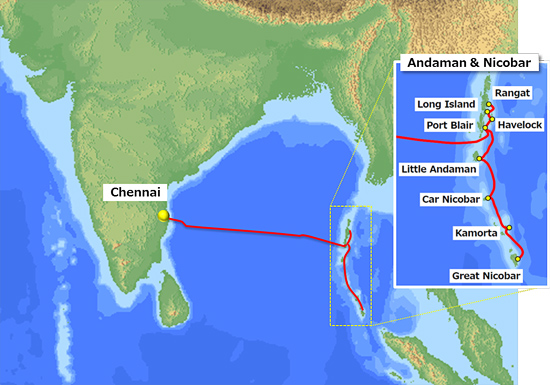
The Andaman and Nicobar Islands, one of the seven union territories of India comprising 572 islands of which 37 are inhabited, are a group of islands at the juncture of the Bay of Bengal and Andaman Sea.
The territory is about 150 km (93 mi) north of Aceh in Indonesia and separated from Thailand and Myanmar by the Andaman Sea. It comprises two island groups, the Andaman Islands (partly) and the Nicobar Islands, separated by the 150 km wide Ten Degree Channel (on the 10°N parallel), with the Andamans to the north of this latitude, and the Nicobars to the south (or by 179 km). The Andaman Sea lies to the east and the Bay of Bengal to the west.
The territory's capital is the city of Port Blair. The total land area of these islands is approximately 8,249 km2 (3,185 sq mi). The islands host the Andaman and Nicobar Command, the only tri-service geographical command of the Indian Armed Forces. The territory is dived into three districts: Nicobar District with Car Nicobar as capital, South Andaman district with Port Blair as capital and North and Middle Andaman district with Mayabunder as capital.
The Andaman Islands are home to the Sentinelese people, an uncontacted people. The Sentinelese are the only people currently known to not have reached further than a Paleolithic level of technology.
Lakshadweep
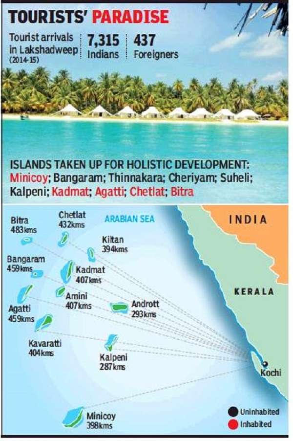
Lakshadweep is a group of islands in the Laccadive Sea, 200 to 440 km (120 to 270 mi) off the southwestern coast of India. The archipelago is a Union Territory and is governed by the Union Government of India. They were also known as Laccadive Islands, although geographically this is only the name of the central subgroup of the group. Lakshadweep means "one hundred thousand islands" in Sanskrit and Malayalam. The islands form the smallest Union Territory of India and their total surface area is just 32 km2 (12 sq mi). The lagoon area covers about 4,200 km2 (1,600 sq mi), the territorial waters area 20,000 km2 (7,700 sq mi) and the exclusive economic zone area 400,000 km2 (150,000 sq mi). The region forms a single Indian district with 10 subdivisions. Kavaratti serves as the capital of the Union Territory and the region comes under the jurisdiction of Kerala High Court. The islands are the northernmost of the Lakshadweep-Maldives-Chagos group of islands, which are the tops of a vast undersea mountain range, the Chagos-Laccadive Ridge.


0 Comments